Flugwetter app for iPhone and iPad
4.8 (
3168 ratings )
Business
Weather
Developer:
Udo Riedel
3.99 USD
Current version:
1.3.4, last update: 4 years ago
First release : 15 Jan 2013
App size: 19.78 Mb
Weather briefing for your pocket - from pilots for pilots.
Aviation weather - The App allows you to easily get weather related information for pilots.
Features:
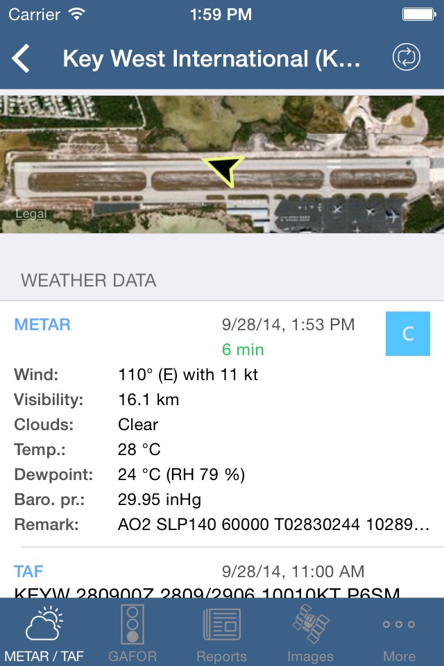
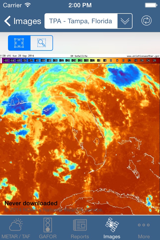
• Get METAR, TAF, SIGMET, SIGWX charts and many more
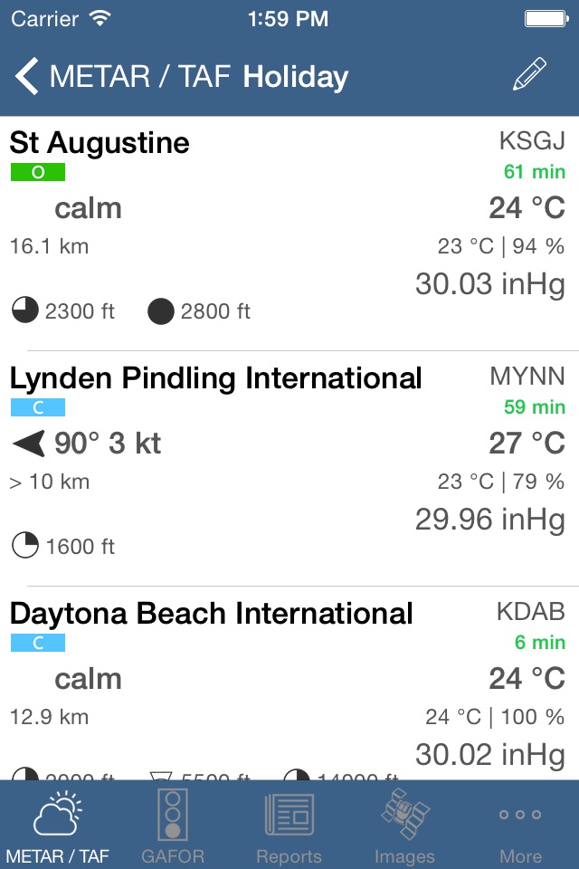
• Cleary represented METAR, TAF and station data
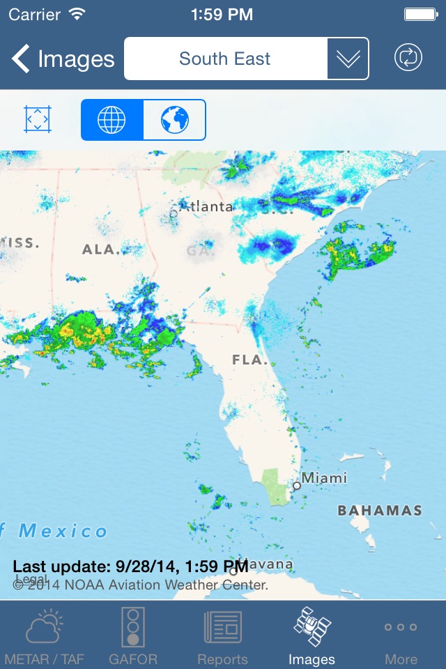
• Current weather on map view
• Use all data (images, current weather...) offline. Download while online and use during your flight.
• Map view of worldwide SIGMETs
• Worldwide radio sounding data
• For iPhone and iPad (Universal App)
• Supports landscape and portrait mode
• Supports Retina displays
• iCloud backup
• GAFOR, GAMET, textual reports ¹
• Static Images (like SIGWX charts, GAFOR ¹)
• Animated Images (like Radar ¹, Satellite)
• Static Maps (like current weather, SWC)
Note:
¹ ... Some content is only available if you have a paid subscription to the pc_met service of German met office (Deutscher Wetterdienst). We currently prepare for other aviation weather services, please contact us if you wish to have another service added.
Pros and cons of Flugwetter app for iPhone and iPad
Flugwetter app good for
Lots of functionality and good alternative to DWD standard app
Just bought it alongside SPL training to understand wheather better and to have necessary wheather briefing at hand. Works perfectly once DWD delivers the online data ( what a hell of a site and system, not even paypal...).
Id love to save sets or favorite info I need most, navigation is not very sexy. But so far runs perfectly.
Some bad moments
I use it dont Review apps but I felt compelled to review this one as it has no ratings yet I initially thought it was just for overseas So I wasnt going to buy it but I figured Id give it a shot anyhow. Im so glad I did I live in Florida it works extremely well here it has a current database of all the reporting airports in my area it automatically helps you choose the best runway based on the current metar that it automatically pulls from the nearby airports it takes that a step farther and has a Satellite picture of the runways at the airport with a arrow clearly showing the direction of the wind across the runway. And without you doing a single calculation it shows you headwind and crosswind component for each and every runway advising which is best. It also has a map showing all the nearby airports with a Vfr IFR or MVfr symbol depending on what the currently metar says- I cant say enough good things about this app and I use it every single time for my preflight and if I have Internet when Im near a runway I quickly check to see which one it is advises - thanks so much